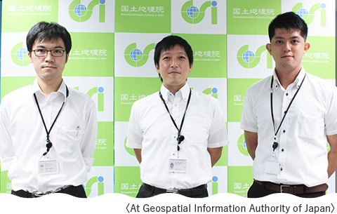
Kawamoto: I joined the Ministry of Land, Infrastructure and Transport in 2006 and have worked at the Geodetic Observation Center of the Geospatial Information Authority of Japan (GSI) and the Geography and Crustal Dynamics Research Center of the Research Division, where I was involved in monitoring diastrophism using electronic reference points, developing technologies related to satellite positioning, and providing data from electronic reference points. I was also involved in creating one of several candidate augmentation signals, which were being considered before launch, for the quasi-zenith satellite MICHIBIKI. Most recently, I worked for two years in the Cabinet Office in charge of disaster prevention, mainly in preparation for the Nankai Trough Earthquake. I have been with my current department since April 2021.
Kumagai: I joined the Geodetic Observation Center when I joined the Ministry and have worked on providing data. I was also involved in maintaining the electronic reference point on Minamitorishima Island.
Hashimoto: I belonged to the Geodetic Department and managed triangulation points. I was transferred to the Geodetic Observation Center this year. The other day, I went to Okinotorishima Islands to conduct preventive maintenance of the electronic reference point.
A. The GSI has established electronic reference points at approximately 1,300 locations throughout Japan. Electronic reference points are a vital infrastructure widely used for surveying and monitoring diastrophism throughout Japan and high-precision positioning in ICT construction and Smart Agriculture. The Electronic Reference Point Division of the Geodetic Observation Center is responsible for maintaining and managing electronic reference points. Electronic datum stations differ from conventional triangulation and leveling points in that they can receive Global Navigation Satellite System (GNSS) signals such as GPS and Quasi-Zenith Satellites. Also, as they contain precision instruments, maintenance and management tasks include visiting the site where the location of electronic reference point to repair or update aging equipment. Furthermore, one of our duties is to precisely analyze the collected data to determine the position of the reference point in millimeters and provide it to the world.

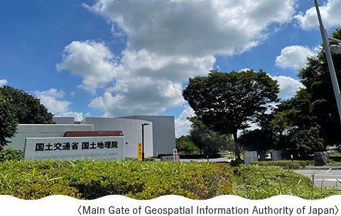
A. GSI is the only national mapping agency in Japan and one of the subordinate organizations of the Ministry of Land, Infrastructure and Transport. The predecessor agency was founded in 1869, so it has a long history of more than 150 years. Through policies related to land surveying and map preparation, it promotes the use of geospatial information. It contributes to improving people's lives and the sound development of the national economy.
A. Currently, maps are generally created by photogrammetry. First, a surveying aircraft takes aerial photographs, and we map roads and contour lines using a plotting machine while viewing the pictures three-dimensionally. Next, road widths and building uses, which the plotting cannot determine, are surveyed onsite. Finally, we edited map symbols and place names and drew the map. The entire process of photographing, plotting, and editing is digital.

A. Triangulation points determine latitude and longitude to know where we are in the world, and level points mean to determine the height of Tokyo Bay from mean sea level. The electronic datum serves both roles, receiving and observing radio signals from GNSS such as GPS and Quasi-Zenith Satellites. Very Long Baseline Interferometry (VLBI) stations also use signals from space to measure the earth, such as precisely measuring the rotational speed and Japan's global position. There are also gravity points to observe the earth's gravitational acceleration and magnetic stations to observe the earth's magnetic field.
A. There are approximately 110,000 triangulation points, 16,000 level points, and 1,300 electronic reference points.

A. In Okinotorishima Islands and Minamitorishima Island, we regularly carry out appropriate maintenance and management of reference points. Both islands are located at the southernmost and easternmost points of Japan, respectively, and the reference points on both islands provide a correct overview of the entire country. Proper maintenance and management of these points give the information necessary to ensure marine traffic's safety, develop marine resources, and create highly accurate maps. The installation of the first and third triangles on Okinotorishima Islands was in 1989, the electronic reference point in 2005, respectively, and the first and third triangles on Minamitorishima Island were in 1992, and the electronic reference point in 2002. Because of the active crustal movement around Japan, it is vital to measure the reference points each time accurately.
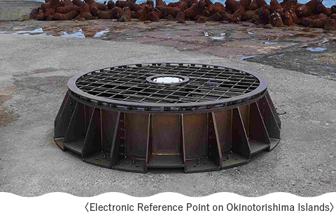
A. GNSS includes Japan's Quasi-Zenith Satellite, the U.S. GPS, and EU Galileo. Electronic reference points send data from these satellites acquired to the GSI in real-time every second. However, on Okinotorishima Islands and Minamitorishima Island, satellite communication lines are used for data transmission, so the observed data is sent in batches several times a day instead of in real-time every second.
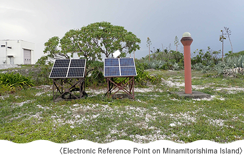
A. We regularly visit Okinotorishima Islands and Minamitorishima Island to replace electronic equipment and batteries. Since both islands are not easily accessible, we replace the equipment at regular intervals as preventive maintenance to avoid delays in observations due to equipment failure. We also check for communication problems and water leakage to the equipment.
A. These get electricity provided by solar panels. There is a housing box behind the solar panel with a built-in battery.
A. The GSI has analyzed electronic reference points precisely at about 1,300 locations in Japan. Analysis reveals the crust is shifting gradually, about 3 to 4 cm per year to the west in the Tokyo area and about 3cm per year to the northwest in the Nankai Trough area. Furthermore, if a major earthquake were to occur, the ground would move significantly, causing crustal deformation over a wide area; during the 2011 Tohoku earthquake, the electronic reference point on the Oshika Peninsula in Miyagi Prefecture moved 5.3 meters horizontally and subsided by about 1 meter in the vertical direction.
A. Recently, I have found that more and more people use web maps. The Geographical Survey Institute's web map, "GSI Maps," can be used to measure distances and visually represent the ups and downs of the land in an easy-to-understand manner. Also, by quickly updating newly created highways and national roads, we can keep track of the latest road conditions, etc. We hope that many of you will make use of this service. In addition to web maps, we publish conventional paper maps. In the mountains, it is more challenging to get a signal than you might imagine, so paper maps are essential in such situations. We hope you will use web and paper maps, depending on the situation.
A. This time, we discussed points on Minamitorishima Island and Okinotorishima Islands, but there are reference points on some remote islands, such as Ogasawara Islands in Tokyo. In addition, the GSI also has a Kanto Regional Surveying Department in Chiyoda Ku, where its employees are engaged in survey administration. Therefore, we hope that when you, the citizens of Tokyo, have the opportunity to see a reference point, you will remember that "the GSI is surveying in such places" and that you will treat reference points with care and become familiar with the survey administration.
 The official website of the Tokyo Metropolitan Government